Mapping the wilderness

Wilderness is essential for biodiversity and resilient ecosystems across the globe, but as human life expands with urbanisation, agriculture, and infrastructure development, it's becoming more and more fragmented.
Professor Steve Carver and his colleagues at the Wildland Research Institute at the University of Leeds have created innovative tools to map the world’s wilderness as a foundation for protecting it.
Video summary
Impact
- Knowledge discovery: collaborated with practitioners, local communities to map the wilderness and wild land in Europe, Asia and America to form the basis of wilderness protection and policies
- Environmental impact: informed several countries' approaches to wild land identification and preservation.
Key information
- Partners and collaborators: Wageningen University, the Wild Europe Foundation, Frankfurt Zoology Society, NatureScot, Snæbjörn Guðmundsson, Sif Konradsdottir, US National Park Service, Chinese Ministry of Natural Resources
- Disciplines: geography
- Investigators: Professor Steve Carver.
Wilderness needs protection
Wilderness areas support endangered species, healthy ecosystems, and the regulation of the climate. They also offer opportunities for research, education, and human wellbeing.
The importance of wilderness for climate and biodiversity has been recognised by the United Nations in its Global Biodiversity Framework, which identified the protection of remaining wilderness as first of its 21 priorities.
There are policies and ambitions to preserve wilderness areas, such as the COP15 Kunming-Montreal Agreement, which aims to protect 30% of the world’s land, sea and water for biodiversity, and restore 30% of degraded land.
To achieve these, it’s first necessary to understand where the wilderness exists and what it consists of.
Mapping the wilderness allows practitioners and policymakers to understand and track the changes they make, so that they can be sure they’re effective.
“Wilderness areas are difficult to identify and protect,” said Professor Carver. “We intrinsically know what ‘wilderness’ means, but it remains an ill-defined and fuzzy concept, making protection difficult.”
Defining wilderness
The research team uses Geographic Information Systems (GIS) and spatial analysis techniques to develop detailed and accurate maps of wilderness areas.
They mapped wilderness areas across the world, including the UK, Europe, North America, and Asia, collaborating with agencies like NatureScot, the Scottish Government, the John Muir Trust, the USDA Forest Service, and the US National Park Service.
Collaborating with practitioners and local communities, the team integrated data about characteristics of the wilderness—such as naturalness, unmodified nature, undeveloped state, and opportunities for solitude and recreation.
“Over the last 20 years, we have developed new spatial modelling approaches to define robust and defensible wilderness boundaries,” said Professor Carver. "In doing so, we’ve provided the information needed for effective long-term protection for the benefit of both humans and nature.”
The maps are essential to developing effective policies on wilderness protection. They can be used to see which areas fall outside protected boundaries and to track the effects of industry and climate change.
International collaboration
Professor Carver’s research is being used across the world to map and define legal wilderness boundaries.
His work with colleagues at Wageningen University, the Wild Europe Foundation, and Frankfurt Zoology Society led the way across Europe, forming the basis for a European-wide definition and mapping programme, including guidance from the European Commission.
In Scotland, Professor Carver, together with colleagues in the School of Geography, mapped the wildness in the two national parks and Wild Land Areas, working closely with NatureScot. The work aimed to capture the essence of wild land in Scotland, with practitioner and public workshops and surveys.
With colleagues at the University of Leeds and University of Nantes, he mapped "High Naturalness" across France. The data is helping to identify 10% of France for strong nature protection.
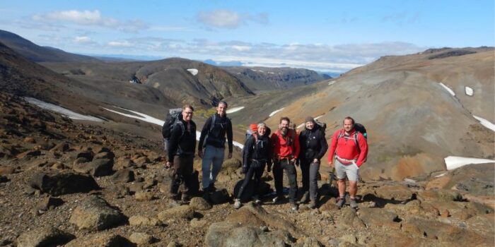
Professor Carver also mapped 48 core wilderness areas across Iceland with ÓFEIG partners Snæbjörn Guðmundsson and Sif Konradsdottir, using the mapping methods developed in Scotland.
In the USA, they worked with the Wilderness Research Institute and National Park Service to develop an approach to mapping wilderness character across the US National Parks.
These methods help the park service to monitor and manage wilderness character, ensuring that wilderness areas are preserved in their natural state for future generations.
Professor Carver collaborated with researchers at Tsinghua University to develop wilderness maps across large areas of China, which were used to underpin the Chinese Ministry of Natural Resources’ expansion of China’s national parks.
Supported by the data, the Ministry plans to create a Wilderness Preservation System covering 1 million square kilometres—it’s set to become the world’s largest protected area.
Throughout their research, the team involved policymakers who use the research to develop and implement conservation policies; businesses involved in land development, tourism, and natural resource management; and local communities who benefit from sustainable land use and natural landscapes.
As well as providing the geographical data for mapping, involving a variety of people in the process improved the understanding and support for the wilderness, protecting its value for biodiversity and mitigation of climate change.

Working together to rewild
Professor Carver co-chairs the IUCN Rewilding Thematic Group, aiming to synthesise and streamline rewilding practices globally.
His work on wilderness mapping has helped inform this work and led to him co-authoring the IUCN guidelines on Category 1b wilderness areas.
He developed the guidelines through workshops in Florida, London, Brussels, Bratislava, and Cape Town, involving over 100 experts and stakeholders.
The rewilding guidelines focus on restoring ecosystems, enhancing biodiversity, and promoting sustainable land use. This work supports global conservation efforts, aligning with the UN Sustainable Development Goals and the Decade on Ecosystem Restoration.
He said: "I am immensely proud of our work in wilderness mapping and rewilding. By providing accurate data and engaging communities, we are not only preserving landscapes but also fostering a global movement towards sustainable conservation; part of the COP15 Kunming-Montreal Agreement's vision to restore and protect 30% of land, sea and water across the planet.
“Our next step is to expand these efforts, ensuring that every region benefits from informed, effective wilderness management. The impact of our research is a testament to the power of maps, to collaboration and our innovation in safeguarding our planet for future generations.”
About Professor Steve Carver
Steve Carver is a Professor of Rewilding and Wilderness Science in the School of Geography. He is the Director of the Wildland Research Institute.
He has over 30 years of experience in GIS and multi-criteria evaluation, having significantly contributed to wilderness and wildland mapping. He has published extensively, with over 100 papers, books, and articles on the subject.